Sunday, 20 March 2016

Top Girls

I guess my time away from the Barbican couldn't last forever. It was back there one Tuesday night to see Top Girls. This was a production by the Guildhall school, so I think we were probably some of the only people in the audience who weren't somehow related to the people on stage. The actors were pretty good, and it was an all-female production, including the stage hands. You don't see that very often!

It's set in the 80's and explores the roles women have to play in order to succeed. The first scene is an historical dinner party, where there are these women from history gathered to celebrate the main characters big promotion. It's all very power women, and the guildhall is literally across the road from my work, so it felt very relevant.

The actors were pretty good, even for students, as was the set design. The main character did seem to stuff up her lines a few times throughout, but where else are you going to learn. And for only £10 a ticket and being across the road from my work, I am definitely coming back.

Friday, 11 March 2016

Witch of Walken

We've been branching out a bit with our theatre going lately. Seeing plays at places other than just the National Theatre and the Barbican. We went to the Arcola theatre to see the Witch of Walken. It's a really cool theatre, quite small, and the stage is surrounded on three sides by the audience. So you are really amongst the action when you are there. We had great seats on the balcony, almost on top of the stage, so we could look down and see everything.

The play was based on a true story, which was a bit disturbing, it was one of the last cases of witchcraft in England. And the true story seemed to be all about some farmer getting annoyed at this woman so kept accusing her of witchcraft until she was eventually found guilty, and was forced to leave the town.

It's kind of cool that it's so easy to get to this theatre, I am loving the London Overground at the moment. East London is a happening place at the moment, and that's all on the right side of town for me.

Monday, 7 March 2016

Monster Day in Glacier

Array of mountains beside us
The second day was our longest day in the park, it was probably 16km or so. It was pretty tough coming after the cold night before. Some people really suffered on this day. I didn't know this, but if you don't drink enough water then you can really feel the effects of the cold. I guess because I have always associated dehydration with hot weather that I have never experienced the chronic coldness you can get. But on this trip you are walking all day, and even though it is not hot you are still sweating a lot and need to replenish your fluids. Some of the group were drinking like half a litre a day, I was doing 2-3L. And at the end of that first day they just got so cold!
Big landscapes
This day was probably the worst in terms of the weather, it just rained all day and was super windy. At some points people were being picked up by the wind and pushed against the side of the mountain, it was pretty full on. So not many photos from this day, we also didn't see much wildlife, I guess because the weather was so wet the animals didn't really want to come out either.

The rain just wasn't letting up

We were staying at fifty mountain campsite that night, right underneath Mt Kipp. This was apparently a bear campsite, in that lots of people had told us there was a bear that would come into camp looking for food. We didn't hear a thing that night though, I think that's a good thing. It would have been super scary to hear a bear snuffling around the tent.
The way we had come
When we went to bed, this was not an attractive looking campsite, the clouds were low, it was constantly raining, all very depressing. When we woke up though we had the best weather the whole trip. Blue skies, warm, the campsite looked completely different, when you could actually see the fifty mountains it was named for.

Just over that ridge are a whole bunch of lakes and glaciers

Wednesday, 2 March 2016

Glacier National Park - Highline Trail

Great mountains in Glacier
After a week in Olympic it was back on a plane and across to Montana. I was a bit worried about whether this part of the trip would actually go ahead. There had been crazy bush fires in the weeks leading up to the hike, roads were closed, towns were being evacuated, it did not look good. When we land in West Glacier it seemed even worse, the smoke was so thick you couldn't see any of the mountains. I was not looking forward to 6 days of walking through that haze, bring on the lung damage!

We were super lucky though, in that when we woke up the next morning it had all blown away, I have no idea how that worked, the fires were still burning, and I don't think they were close to being under control, but somehow there was no smoke. Even without the smoke we did not have great weather for this hike, though I guess it was good weather for fighting bushfires so you couldn't complain too much. It wasn't like Olympic, were it didn't even rain in the rainforest. It was nearly every day that it rained. Pretty heavy too.

When the weather was still nice
I don't think I would recommend the guiding company we used for this trip. The main reason we used guides was because we didn't want to have to deal with the bears. We have no idea what is bear safe and what isn't, we wouldn't have known how to set up the food away from bears or where to get bear spray or anything really. And this park didn't just have brown bears, there were grizzly bears in this one, they are much more aggressive than the brown bears. So we thought we would play it safe and get a guide. The problem was they had way too many people on the trip. It was meant to be two trips going out, but then 2 people had pulled out, so they combined the rest of the groups into one and sent them out together.

There ended up being too many people to fit in our allotted camp sites, which meant it was really hard to get the flys tight. And we could never take the bigger camp sites, since they were the ones that the rangers checked, and we always had too many tents per site. It was a pretty poor showing by this company, given that they are the only ones allowed into the park.

Remnants of snow fields
The route we had was a pretty good one though, the company had managed to get some good permits. The first day was probably the best in terms of views, along the Highline trail, which is this trail blasted into a cliff face. It was about 11-12km the first day, and fairly flat, which was nice to get used to the pack again. The weather got pretty bad by the end of the day though, I think maybe we were going too late in the season, it being early September by the time we were off the trail. I think our trip was the last of the season, and that first night certainly felt cold. I think the first night is always the worst though, I had all my clothes on and was cursing my sleeping bag for being too light-weight. And yet by the end of the week I was too hot in the same bag, and the weather hadn't noticeably improved. I think it just takes a night or two for the body to get used to sleeping outside.

Great views, though the weather is closing in
The weather was so bad that night, luckily we have an awesome tent, so all our stuff was fine. Other people were not so lucky, that is never pleasant, to start the week's walking with a wet sleeping bag. It started to really rain about 2km from camp, which I think is one of the worst times for it to rain, just long enough to get wet, then you are cold trying to set up your tent. What was even more disheartening is that you have to pass a chalet to get to the campground. This was the only chalet we saw all week, and it was just at the worst spot for us. You are all cold and wet and tired after the first day, and you can see that there is a place where you could instead be warm and dry with a cup of hot chocolate. But that is not what we had signed up for!

Friday, 26 February 2016

Dover

Running alongside the cliffs
We found a new running series, the coastal trail series. It's whole idea is to run along the coast somewhere. The UK has a lot of coast, and a lot of it is pretty nice, so long as you don't want to swim in the sea. Even though we've been here for a while now, we still hadn't visited the cliffs of Dover. And this race series allowed us to actually run along the cliffs. How could we say no? It was only when we turned up that we discovered that any pictures you may see of the white cliffs of Dover are usually filmed in Sussex. Still the ones we saw were pretty white, and there was even a castle there.

This has got to be one of the toughest races we have done, we signed up to do a 10km race, then it turned out to be 12.3km, that's not an insubstantial increase in the race. The worst thing was it was incredibly muddy, I have been in some muddy races, but this was crazy. The real problem wasn't the mud so much, it was more that the ground underneath the thin mud layer was completely frozen. You just couldn't get much purchase, I managed to fall over within 200m of the start line. That was a bit painful.
Dover castle - didn't even know this existed
Otherwise it was a great run, good views and blue skies. I've done a lot of muddy, long 10km races this winter, I'm kind of wishing I had signed up for a flat, road race somewhere amongst all that.
The lighthouse - the trail dried up for the second half
The finish line was the muddiest point of the whole race, you were finally finished with this slog, had climbed the last hill, and you want to do a nice run across the line, what with everyone watching. Yet it was so muddy you had to just tip toe your way across hoping not to slip. It was a bit of a let down. The poor ultra-marathoners had it the worst, they had to slog through 56km of mud and hills only to get to the end, when all your stabiliser muscles are gone, and try to inch their way across the finish. Some didn't make it, and it took them a long time to stand up again.

The massive Dover harbour, with herd of horses

Sunday, 21 February 2016

The Queen of the Park

Mount Olympus in the distance
The last walk we did in Olympic was just amazing. I had found it mentioned a few times on the web, the High Divide loop, sounded just want I was after. A high ridge circular walk. Only downside was that it was 33km with something like 1200m elevation gain, but I thought we could manage that. We just had to keep moving. Most of the time this is done as a 2-3 day hike, so nearly everyone else we met on the trail were doing it in a few days. We did meet another person who seemed to be doing it as a day walk. They were super fast, like Olympic walker fast, it was quite incredible watching them go. They also managed to overtake us twice without us ever overtaking them, not sure how they managed that.
Deer lake - didn't see deer though
Waterfall at the start
I can see why the campsites along here are some of the only ones in the park which require proper reservation permits. It really was the queen trail of the park. A loop, a ridge, amazing views, lakes, forests, mountains, it had it all. We started pretty early, so nobody else was on the track, in fact we didn't see anyone until we hit the first campsite. It's a bit of an uphill slog for the whole morning. We had lunch on the top of Bogachiel peak, and from there it was almost all downhill.

I unfortunately stopped taking photos kind of early in the day. It was so incredibly hot and we ran out of water with 5kms to go. That wasn't pleasant, we could have filled up from a river if we were desperate, I should have taken my steripen with us. I have a new awesome backpack with bladder. I'm totally sold on the bladder idea, one downside is that you have no clue how much water you have left. It would be nice to have some sort of warning message somehow. Since it was so hot I was just sucking it down, and really I should have rationed a bit more carefully.
View of Deer Lake, we started in the valley below that
The end of the walk was really great too, you are following a river through this thick forest, and the trail is lovely and soft under your feet. And it is all downhill, there is hardly even one step of uphill, so I really should have mustered the energy to take a few more photos. The trail was fairly quiet too, except right at the end when you reappear back on the waterfall track, apparently there had been a bear sighting right at the trail head, so everyone we met was pretty excited. We saw no bear though, must have eaten it's full of tourists by the time we got back.

Seven lake basin
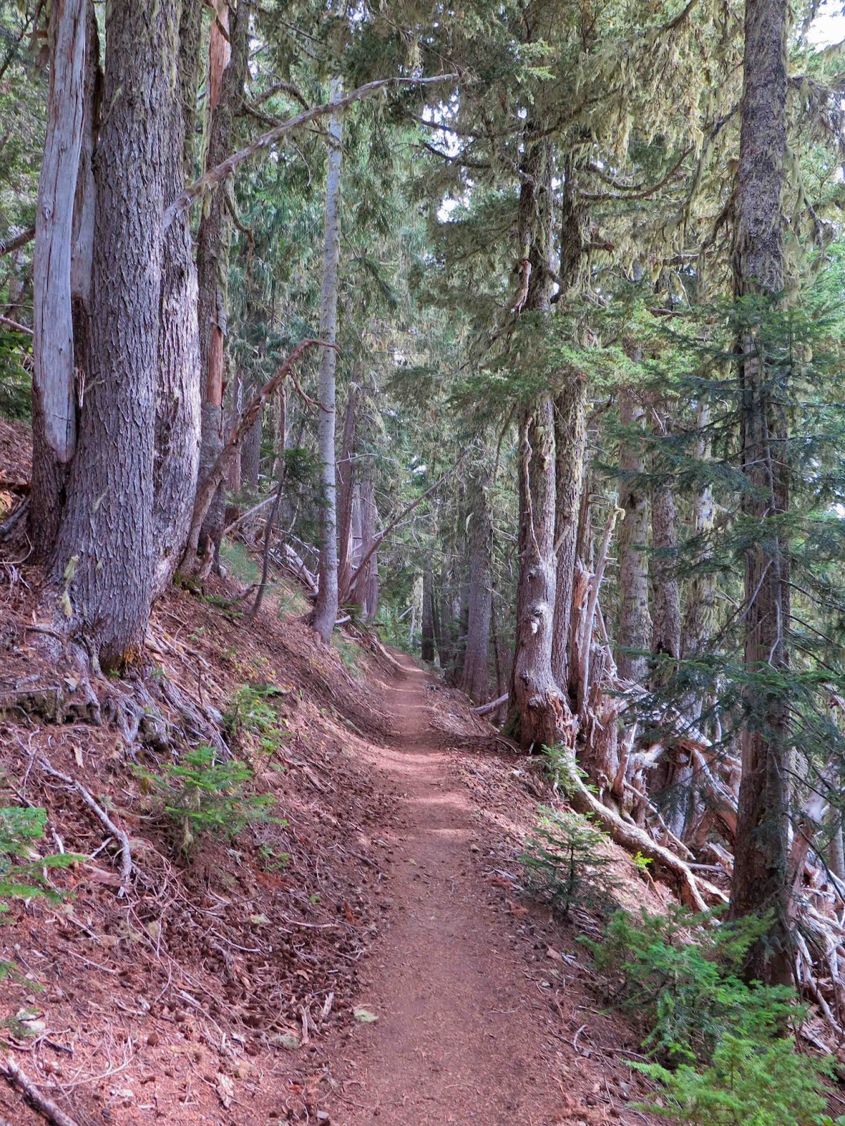
Typical trail - great forest
We weren't really worried about bears on this walk, the biggest fear was mountain goats. There were heaps of signs up saying beware of the aggressive goats. These are not little spindly ibexes or anything but massive goats, if they decided they didn't like you they could definitely cause trouble. They had once gored someone to death, so you don't want to come against one of those. Though in the end we didn't see any wildlife, no bears, no deers, no goats. Perhaps it was too hot for them.

The trails the whole way round were great, it was only right at the start that we managed to go wrong, again I blame Scotland. I'm just not used to these beautifully large trails. We managed to follow some muddy deer track for a few hundred metres before we realised it was going the wrong way. Overall it was super easy to follow the trails, which was good, since we didn't have much in the way of a map, no 1:20000 for this walk. There were signposts at all the junctions though so really it was pretty easy.
Mt Olympus with glaciers
You get a fantastic view of Mt Olympus on this walk too, much better than what you get at Hurricane ridge. It feels like you are a lot closer to the mountain, and it really does look foreboding. It's like an open mouth, with sharp teeth and full or ice and snow.
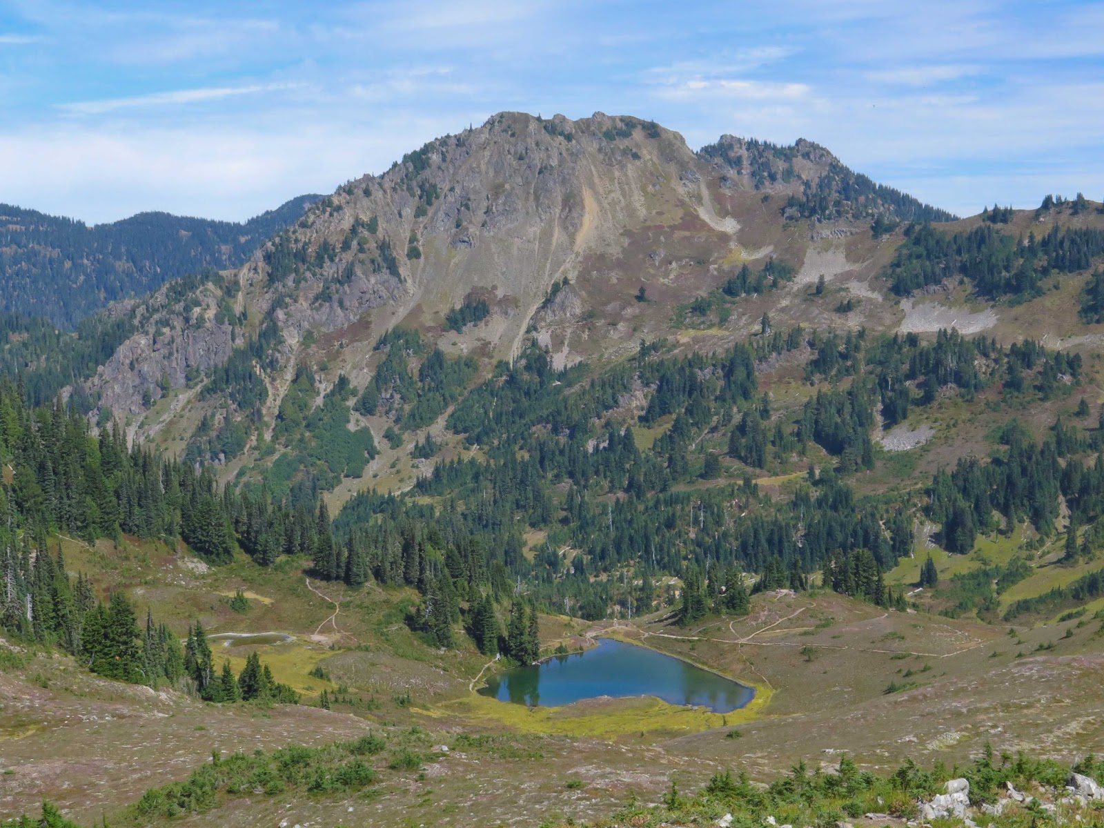
Heart Lake
Once you have looped around Seven Lakes basin, which looked strangely volcanic, and had your fill of the views over to Mt Olympus it was then the long descent. Starting with a stroll down to Heart Lake, it really did look like a heart. And the forest below this lake was just amazing, some of the best I'd been in. We hardly saw the sun for the rest of the day, since the canopy was so thick. I can't recommend this loop enough, it really is one of the great (long) day walks.

Tuesday, 16 February 2016

Olympic - Hurricane Ridge

Surrounded by ridges
Olympic national park really gets its name from mount Olympus, so we definitely had to spend some time with the big mountains of the park. It was back to Port Angeles, which is at the base of Hurricane ridge, it was nice to get out of Forks, I have to say. Definitely try to stay somewhere other than Forks when you visit. We were a bit tired after the 16km along Hoh river the day before, so did the easy walks from the Hurricane ridge visitor centre. This place is tourist central, so don't bother trying to ask any questions of the rangers, they are overwhelmed with people. You don't really need to speak to anyone though, there are lots of maps around the place.
Can just see mount Olympus peeping up behind the ridge
Funny, fat marmot
It was surprising given the sheer numbers of people how much wildlife we saw. This was wildlife central, we saw marmots and deer and a weird bush turkey thing. Easily the most wildlife the whole time we were there. The marmots were pretty funny, I think they have their own species in this park, they were completely different from the ones we saw in Spain, really fat, with black on them. They still made the classic marmot call though, which was pretty cool. They really didn't care about people, I guess if you live on this ridge you are going to get used to people.

Again here you could really see the effects of the drought, everything was brown and it was super hot. We climbed Hurricane hill, which was 1700m, it's funny to think we were already almost as high as Australia, and had barely done any work. And there were still mountains much higher than us.
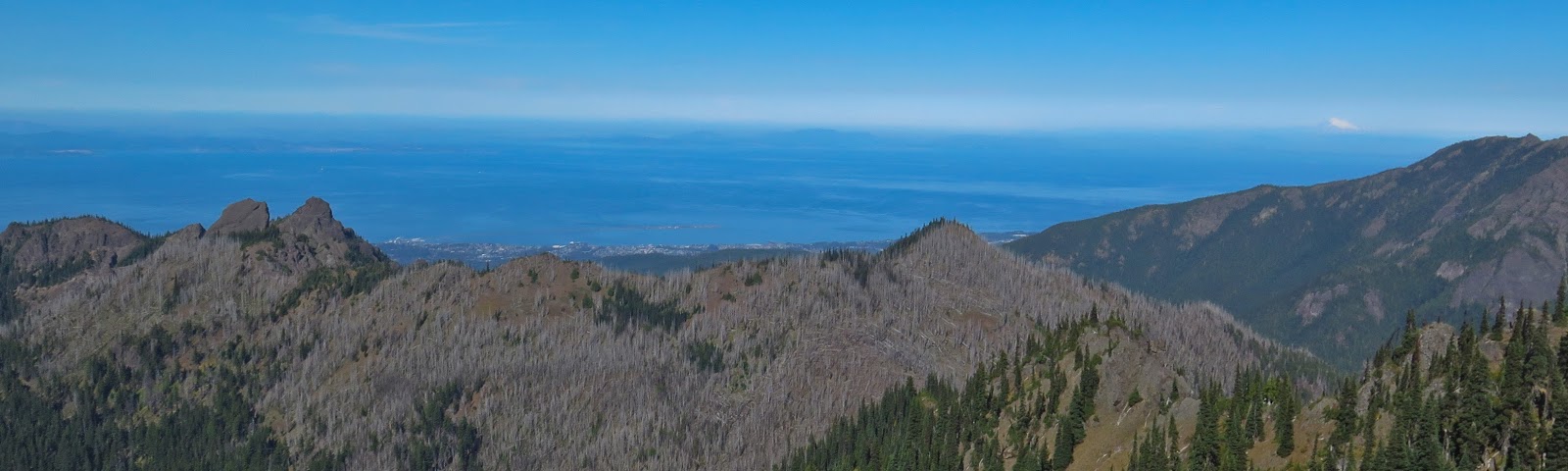
View to Canada, with Mt Baker appearing to the right
From the top of the hill you could actually see across to Canada, that was also pretty cool. It really is quite close to Port Angeles, you just have to catch a ferry across quite a narrow strait. We could also see Mt Baker from the top. That was surprising, to see across water to some snow capped mountain. I was expecting that at all. The dead trees in the foreground are from a fire I think. Visiting when we did you could definitely feel that forest fires could be a danger, it was so dry and hot, and I think pine burns like crazy.
Quite pretty around here.
It was really a very pleasant stroll, and well worth the slog up to the top. I would highly recommend visiting here, even with all the people, because the views are just amazing. Plus marmots!